Aerotas regularly provides thought leadership for Commercial UAV News from the perspective of the land survey industry. In this post, Executive Editor for Commercial UAV News, Jeremiah Karpowicz, offers his perspective about how land surveying stacks up in the drone industry.
POB Column: It Matters Who Processes Your Drone Data
When the American Society of Photogrammetry and Remote Sensing (ASPRS) launched their Certified Mapping Scientist-UAS certification, Aerotas Founder Logan Campbell was among the first people to sit for the test. The intensive experience of studying, preparing, and taking the strenuous exam highlighted how challenging a verifiable understanding of photogrammetry is. However, the real-world experiences that Logan and the Aerotas team have with processing drone data for surveyors reveal the importance of this understanding in the real world.
POB Column: Selecting a UAV Georeferencing Option
With Aerotas' position as the preeminent provider of drone solutions for land surveyors, we constantly field questions from surveyors about various components of drone technology. This is the third in a three-part series of articles in Point of Beginning magazine, summarizing our current analysis on key components of drone survey technology. This article focuses on the georeferencing options we most commonly get questions about -- particularly high-accuracy RTK, PPK, or Direct Georeferencing systems.
POB Column: Drone Sensors for Surveyors
With Aerotas' position as the preeminent provider of drone solutions for land surveyors, we constantly field questions from surveyors about various components of drone technology. This is the second in a 3-part series of articles in Point of Beginning magazine, summarizing our current analysis on key components of drone survey technology. This article focuses on the sensor options we most commonly get questions about -- particularly LiDAR.
CLSA Webinar: Drone Surveying Best Practices
Last week, the California Land Surveyors Association invited Aerotas co-founder Daniel Katz to present a webinar to their members on best practices in drone surveying. With the experience from training and equipping several hundred surveyors nationwide to get best-in-class accuracy and ROI from drone technology, and completing thousands of drone photogrammetry and linework drafting projects, the Aerotas team has learned a great deal about what it takes to benefit from drone technology.
POB Column: Drone Airframes for Surveyors
Point of Beginning magazine asked Aerotas co-founders Daniel Katz and Logan Campbell to analyze the various components of drone technology that go into an effective drone survey program. They evaluated three key technologies across three articles: drone airframes, sensors, and georeferencing options. In each article they take an independent and analytical approach to evaluate which drone technology option is best for land surveyors. The first article focuses on drone airframes.
Commercial UAV News: Surveyors and Other Professional Drone Operators Should be Focused on Accuracy and Reliability
In a guest article on Commercial UAV News, Aerotas co-founder Daniel Katz discusses some of the misconceptions Aerotas sees surveyors frequently bring to their drone program decision-making. Many surveyors often that they need to choose a drone billed as "professional grade," but What matters is accuracy and ROI.
Drone Surveyors Can Now Fly Near Airports
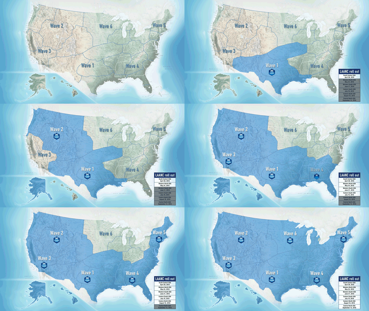
The FAA has officially started rolling out the system that allows instantaneous airspace authorizations. LAANC is the FAA’s new system for permitting commercial drone pilots to fly legally in controlled airspace near airports instantaneously, rather than the previous months-long manual process. This program is a huge boon for surveyors and engineers who work near airports, however there are a few things to know about LAANC before going out and flying next to a runway.
POB Column: Drones Help Survey After Thomas Wildfires
POB Column: Does Your UAV Survey Program Measure Up?
In the most recent issue of Point of Beginning magazine, Aerotas co-founders Logan Campbell and Daniel Katz lay out the basic expectations for a surveyor using a drone: what they should be getting, and what it should cost the in money, time, and staff. Ultimately what this translates to is getting the best possible cost/benefit ratio, so that the return on investment for the drone program happens as soon as possible


