CLSA Webinar: Drone Surveying Best Practices
CLSA Webinar: Drone Surveying Best Practices
Last week, the California Land Surveyors Association invited Aerotas co-founder Daniel Katz to present a webinar to their members on best practices in drone surveying.
With the experience from training and equipping several hundred surveyors nationwide to get best-in-class accuracy and ROI from drone technology, and completing thousands of drone photogrammetry and linework drafting projects, the Aerotas team has learned a great deal about what it takes to benefit from drone technology. Click the video below to watch, and if you are ready to get industry-best accuracy and profit, submit your information below.
Learn more about implementing an industry-best drone survey business:
Webinar Transcript
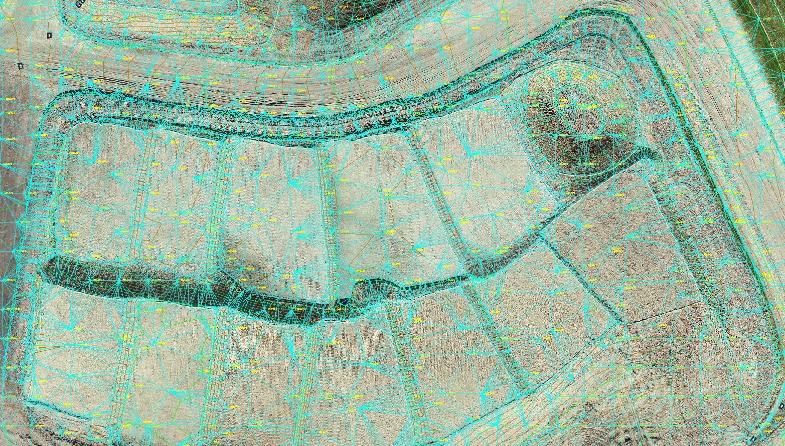
hi everybody thank you for joining us today for the webinar on your own surveying presented by Daniel Cass please any questions or comments into the question box or the chat box and we will address those at the end I'll come save the date our next 11 2018 the topic will be hi that I will hand it over to Daniel thank you thank you so much Kim so Kim mentioned I'm Daniel Kath I'm a co-founder of arrow talks I'm going to be covering some details on best practices and groans surveying a couple quick notes on housekeeping I'm going to be covering a fair bit of information in a good amount of depth and if anybody wants it so be a lot of information on slides and what have you Kim has said she'll she'll send me the list of attendees after the fact so I'll just go ahead and plan to send this actual slide show presentation out to to that list so don't worry about furiously taking you know scribbling down notes or taking screenshots I'll just plain to set this out after the fact and as Kim said go ahead if you have questions throughout feel free to put those in the chat box Kim will collect those and I'll do my best to leave about 10 or 15 minutes at the end to address those questions if you do have questions that are more individual or specific to to your your operation or what you're looking to do you can just go to that URL on the bottom there go - Erika's calm and submit your information and my team will follow up and we'd be happy dance or any other specific questions you have so on that note of a word of background about arrow toss a short version of what we do as a company is we work with surveyors to get the maximum benefit out of drone technology obviously this technology has a ton of potential but as I'm sure a lot of you who are here are experiencing it takes a lot of know-how and a lot of nuance to get to get it right and to really maximize that benefit it's generally speaking we do two things we help teams start up and running with drug programs provide training provide the equipment everything else you're going to need and then we help them get the line work on a big project by providing data processing CAD drafting as a service so it's a little bit of background about us and kind of be what has led us into you learning a lot of what I'm going to be walking walking through here today so basically I want to share with you some of the the hard learned lessons that we have learned about how to build and operate a drone program for course survey applications so big picture first thing to understand is when thinking about using it to I you actually need to think about it as being part of a complete drone program and a drone program consists of five key components and I'm going to walk through each one of these through the course of this of this webinar first up anybody's going to find the drone needs to have a license I need to know what the regulations are that you're interacting with and how to comply with those you get insured specific to your drone operation I need to have clear standard operating procedures that are guiding how that data collection is being done using the drone in the fields then obviously you need to have the drone itself and all the other kind of supplemental gear you need to operate that drone and then last and probably most critically is you need to have a good efficient way of actually getting to final line work and this is important kind of level said a drone should not be just a marketing tool or something that's getting pretty pictures used right a drone it absolutely can be and should be a survey tool it should be enabling you to get to final topographical planimetric survey deliverables so go ahead and walk through each one of these in turn on the last one the on the actual line works well I'll even show a quick example of what we have found as much efficient way to get to that line starting at the top with the license anybody who is going to be actually flying the drone the quote-unquote piloting command must have a special drone pilot license most commonly this is referred - as a part 107 license as the body of FAA regulation that governs this I also see it referred to as the our PICU remote pilot in command certification or license what it takes to get this it actually just takes passing a knowledge based test that is ministered by the Federal Aviation Administration out of anyone about we have 500 testing centers in the country so it's just a knowledge based test doesn't actually why required going out and doing any practical tests it's not like your driver's license we have to go and show that you know how to drive the car and having said that is pretty technical so good rule of thumb for this anybody can pass this this test but you do have to expect that you're going to need to do some preparation and and some studying before going in think of it like your driver's license test the first time you you had to take that test totally possible anybody can do it but it does it does definitely require for most people a fair bit of studying of preparation there are a lot of resources out there out there that uh that can help get you through this this process the FAA actually put out a handy study guide which is 600 pages long so I definitely recommend looking for some more efficient resources I know a lot of local community colleges have started offering courses specific for prepping for the drone pilot license exam other also a handful of providers who offer online courses you should expect to spend on the order of four to eight hours worth of studying in order to be able to go in and pass the exam what's nice is the exam you'll actually be a 70% on the exam in order to let's consider a pass and so it can be helpful to there's some there's some areas information that are completely irrelevant for actually flying a drone I really get into the nuts and bolts of how aviation works and it can be okay to say you know what this stuff's really complicated this specific topic I'm going to go ahead and just plan to get back question wrong I'm gonna focus my energy over here oh I can I know I cannot study up on on these topics and get those questions right ultimately what matters here is that the person who's out flying the drone has that license there it's their ultimate responsibility to make sure the operation is safe and legal and so that means they also have to have good understanding of how the regulations work in terms of the projects as they are doing next up is insurance now the reason that drone specific insurance is important for most survey operations is because pretty much every standard commercial liability policy has a aviation exclusion and this basically this is a clause in that liability policy that says pretty much if it flies it's not covered by this policy this obviously comes from the legacy of manned aviation which is fairly higher higher risk profile but it does apply to to drone operations as well so you basically need to get a policy that will plug that that aviation exclusion gap in your current coverage this is becoming fairly easy to get most commercial brokers will have a way of going out to the market and securing a policy we work we really like working with company called transport risk management who manages the large majority of drug policies in the world we find in our experiences points of being a bit more cost effective and get better service if you go with a a kind of purpose a drone specific provider ultimately there are two two types of coverage that you want to put in place liability and what's held home think of this like car insurance we've got your liability coverage your collision insurance so liability obviously covers if the drone does damage do something else if it runs into a light post in the light post needs to be repaired or somebody trips over it in the office and hurts themselves a hullick coverage is like your collision insurance in your car where that is going to be the coverage that kicks in - to cover the cost of repairing or replacing the drone itself so if you know again you run into that light post and this will kick in to cover repairing or replacing the drone or even if the water being down the road breaks and your office squad team enjoys destroyed so generally what we recommend putting in place pretty good benchmark for liability most most companies are good with about a million dollar policy that's kind of proving to be to be pretty standard next step after insurance is what is often one of the more important components to a drone program actually being successful that is most often overlooked in our experience when we work with surveyors who have some degree of drone program at place maybe they've gone out they bought the drone and they've tried using a couple projects usually this is the component where they are struggling the most and that is holding them back the most from being able actually use this as a survey tool and rely on the data they're getting out of it so standard operating procedures are not sexy but they're also the most important thing for driving viability profitability and profitability of this tool ultimately the importance of standard operating procedures is that they allow you to your operator to sidestep stumbling blocks that are likely to come up the ones that are predictable and the ones that are less predictable ultimately these SOPs should cover to make sure that every operation is legal that it's safe sufficient and therefore profitable and that yeah most importantly for surveyors it is accurate and gets you repeatable results now what standard operating procedures actually cover is it's really a lot all of this ultimately you know the ultimate goal like I said is getting to good repeatable results you want to have your field operations standardized so that regardless of which serve air goes out regardless of whether it's palm Sally or hair who's taking the drone out today I could do the data collection and you know you're getting equivalent comparable a comparable results back the data that is going to be collected is going to be collected in the same way so you know you can get expectable consistent results so the challenge with standard operating procedures and say this from experience of us having developed these is that they need to be both comprehensive and simple so you kind of threw a laundry list on here are the kind of things that should be covered in in standard operating procedures for drone surveying everything from ground control planning in terms of lamp marking to how you set up a flight plan set up the autopilot the mission all the pre-flight preparation that happens legal side equipment side basic kind of guidelines and walkthrough of executing your standard survey mission and then also how to deal with things going wrong unexpected emergencies happening low-flying emergency helicopter coming into your your project area and then after the project walking you through all the post-flight things I need to happen making sure you're logging everything you're doing record-keeping and doing the basic maintenance and and good storage practices so this is something that you know I I often encourage folks but before you even go out and start shopping for a drone this is good place to put your energy first because your standard operating procedure is going to guide towards understanding what is actual drone that you need in order to execute on the projects that you're trying to do now on that note you know it's a like I said that the drone often is less important than those standard operating procedures but obviously picking the right row is important we have a benefit as a company of not we're not formally affiliated with any specific drone manufacturer or any provider of anything and so that allows us to do that intentionally to kind of maintain me maintain flexibility maintain independence and the ability to go out and audit and analyze everything that's on the market to make sure that we're choosing the best tool to provide to our customers so I will walk you all through is basically what our and that kind of analytical process is our decision-making criteria for assessing the equipment on the market to decide what what is the best best tool for drone tool for most surveyors to use an important level set here is when when you start out looking at technology the most tempting thing to do the most intuitive thing to do is start looking for tech specs they'll look for every drone you can come across and try to get all of the technical specifications on that drone about everything you can figure out you know a wingspan the fly I'm voltage of the batteries what has you but ultimately what matters is not necessarily those individual tech specs not even the ones that you know that's the completely critical like camera resolution what matters is what's what is going to get you the dislikes that you need so for surveyors the foundation of the thing that matters more than than anything else is going to be accuracy so what we we always encourage is start this this process between what we do what we do when we're evaluating tools we need to start with what is the actual field tested accuracy of this drill regardless of what the laundry list of tech specs says what kind of accuracy can we expect out of this remote based on ground truthing and field testing over what amount of acreage per hour obviously if I can get down to a three hundredth but I can only cover 100 square feet per day that's not going to be an efficient source at work where's the investment so it's actually that accuracy by acreage by our how much ground can you cover per hour at what level of accuracy ultimately the only way to do this is with field testing strongly encourage folks to always go out and ground truth in field test it's the tool that they're considering using before for certain works one two of a kind of assessment found or maybe a handful of drones that can get you got accuracy accuracy by acreage you need a next thing to think about is reliability and you know obviously reliability matters because you need to know that every time you take this tool out you're going to get you're going to be able to use it you're going to be able to get the results that you need you're not going to have to be replacing it before you can make your money back on it now often when the way we approach reliability is actually to think first about simplicity simplicity matters not because you know people are dumb and they need it too all that that's super easy to use simplicity matters because it's simple tools less likely fewer moving parts fewer complications to it mean that they're they're fewer things fewer ways for things to go wrong so you want something that's going to be easy to set up for the first time easy to go through those fields field projects that have processes require minimal maintenance in part because that's going to mean that your you're getting the efficiency that you need it's getting you to that it's providing that time savings in the field but also because it's going to mean you have the least chance of those two things going along and the least likelihood that you get out onto a project site after driving for two hours pull the drone out of the case and something goes wrong so you can't sit and you have to come back another day you've now lost a lot of that ROI time savings benefit of this then obviously the last criteria to consider the last factor is price obviously you know it's buying an incredibly expensive tool and it is less less helpful for a business because it puts you in a deeper hole for getting cd+ otherwise it's harder to get that return on investment it's not that expensive tools are bad it's that it puts you in a high-pressure situation in the business you have to figure out how to absolutely maximize your utilization this tool how to charge extra for that you can earn back that investment if instead you can find a pay a drone that is going to get you that accuracy and that reliability at a lower dollar point that's relieving a lot of that pressure and making it easy for this to become a profitable tool something you can use use automatically without having a hot bath therefore this pressure and when thinking about price it's not just the price of airframe itself I bet it's the all-in cost including of course the sensors but also all the support equipment you're going to need spare batteries replacement propellers rugged carrying case that you want to be able to put this into and throw it in the truck and then also insurance similarly again the car insurance the main drivers cost in drone insurance is going to be the cost of the actual way of right so cheaper drones cheaper insurance so this is kind of how we approach analyzing all of the components that go into that go into a physical kit or using the drug program so with that I'm going to walk you all through a few of the key components that we get the most questions about which are options in terms of drone airframes in terms of the actual sensors that those airframes can carry and an option for georeference and how you actually get to that corrected and click bottom and again this this comes from where we don't have a we don't have a dog in this fight I'm not you know I don't have somebody sitting behind me saying make sure you know you kind of endorse this type of tools this is based on us going out and doing our independent evaluation of the market which has resulted in aa stews and they're providing the the technologies to our clients that we do so in terms of airframes broadly speaking you can consider three different categories of airframes we've got small multirotors large multi rotors and fixed wings multirotors are going to be basically fly like helicopters they take off and land vertically they can hover in place like a helicopter they can make tight right angle turns they can fly really slowly well as fixed-wing is going to fly more like an airplane takes off at a slope flies and kind of longer makes longer swooping turns comes in and Landsat afloat a small multi rotor kind of best and breed is the DJI DJI phantom4 professional this is you know kind of spoiler alert this is the drone that that we have found provides the best results this is the one that we provide to our clients recommend there are other small multirotors out there of course generally speaking they're going to be around a foot and a half in diameter so fairly small really usually only a couple pounds I'm all in something about that all in cost including the sensor including the supplemental equipment you need including insurance it's going to be on the order about four thousand dollars at the end of the day in the accuracy you can expect with again the right Tanner operating procedures in the field the right data workload be a tenth or sometimes even a bit better than a tenth vertical large multirotors kind of the the industry leaders here again DJI with it M 200 series maturity mitrice 200 series or the 600 series on micro drones also is another kind of leading provider of these larger multirotors these are going to be more like closer to three feet in diameter so substantially larger on the range of depending on what they're carrying anywhere from ten to thirty thirty pounds all in its you know pretty pretty wide range but you know can easily be well about twenty thousand dollars even up to a upwards of seventy eighty thousand dollars accuracy is also going to be kind of feel true accuracy expect to accuracy is going to be similar to a small multi-rotor at about a 10 six wings can learn more more common with here Trimble has their ux5 or sense fly as their EB gonna be about three feet in wingspan usually they're made out of this pretty dense foam so they're they're fairly light similar weight actually a small multi-rotor considerably more expensive I think there are some models there they're as inexpensive about $25,000 and they can easily get upwards of sixty to seventy thousand dollars and these are going to be sufficient for getting you accuracy you need for contouring in general so we walk through kind of the trade-offs with each of these airframes so the main benefit of a small multi rotor this shouldn't be surprising to hear based on what I through in terms of our kind of analytical framework super easy to use super reliable really inexpensive that the particularly at santa for pro it just it just works on its you know it's the most produced aircraft in history so it's they're able to make it for really cheap they've worked out all the little kinks so we you know it's the most reliable airframe on the market your main drawback missing the edge slats flexible it cut actually has a built in camera which is is pretty common on these smaller multirotors so you can't swap that camera out if you decide that you want in two different types of sensor down the road really this is one tool for one type of job you know kind of a trade-off with it being because it says closed system that's a big part of what makes it so reliable so inexpensive and so these used but also we tell it is less flexible in our experience for most surveyors most survey work most projects there's gonna be the right tool for the job okay that it's not that flexible because it can get you the accuracy you need on most of the projects that you'd be looking to do large multirotors main benefit of these over a small multi rotor is going to be how customizable they're yeah you can you know these are more flying platforms that you can swap sensors on to i can really modify them to whatever you need that does come with the drawback of them being complex and expensive they are much much more more involved to using a set up for the first time we're going to use with field complexity means things aren't going to work sometimes which means you're going to lose time that's a quick anecdote on that front we recently did had a local engineering firm that had a DJI m600 there premier engineering firms in the country in the region and they they refuse to believe us they did not believe us that a phantom or Pro could get as good accuracy 600 so we decided to go out and kind of do a side-by-side comparison so we set out a test site went out there on the same day we went first of the span of coal fro took about 15 minutes to set it up by the site pack it in I mean it was pretty pretty simple they wound up having to come back four times with their m600 before they can actually get the data collected because each time they go out something wouldn't work right yeah when there was the interface between the drone and the big camera they had mounted onto it some issues with software and there's just there's so many moving parts in the drone I want to taking them for field trips to actually get the drone up up into the air and collect data and again these are very very sharp folks they have a lot of experience with drones these are just really complex tools and then ultimately when we we did get the data half the photos were blurred and nobody could figure out why so ultimately really the the best case the right time for using these types of larger multirotors are going to be if you have the need for to do something really specialized your business involves doing roof inspection as well where you need to be able to mount a thermal camera sometimes you can see what you freaking out or bridge inspections you need to be able to put a top mounted camera on to look on the other side of the bridge but I would even consider these as you know if even if that's part of your work I would still use a small multi rotor for your bread rather provide our survey work and then this is your it's large multi rotor is your tool for those specific projects with a fixed-wing your main benefit is going to be like time an airplane style airframe is just a fundamentally more efficient way of flying then then a multi rotor so they can sail off for a lot longer while usually average means you can cover more ground unfortunately that benefit of range is negated by the state of regulation right so one of the the main laws governing commercial drone use except you have to keep the drone within line of sight be prioritized why and frankly a small multi-rotor can already fly further than you can see it so in most cases having that ability to cover a ton more ground it you can't actually take advantage of it in addition to that there are a couple other drawbacks to be aware of six wings by and large when when they fly they when they land they belly land they come in and they they basically just kind of land on their you know come in and land at a slope on their belly which is great as long as you only ever do projects on nice manicured golf courses obviously if you're landing in dirt around asphalt or things like that the the airframes get chewed up pretty quickly and the because the camera is melted into the airframe you know it doesn't take more than a poorly placed a small rock in order to do some serious damage to a sensor they also are capable of substantially lower accuracy than multirotors are the reason for that is some of the kind of physical dynamics of how six wings have to fly fixed wings have to maintain a minimum flight speed in order to stay aloft I have to fly fairly fast in order to keep up keep flying and that means that they have to fly pretty high so that you don't get bad motion blur on the ground and they can't carry a terribly large sensor because they are because weight is so critical on a fixed wing so you wind up having to fly high with a fairly small sensor so your ground resolution is pretty low meaning your accuracy is also fairly low also whereas a multi rotor can carry a gimbal that allows basically the camera is mounted via gimbal to the airframe that allows the camera to move independently of the airframe so when they when the drone is turning when it's fighting wind that gimbal keeps the camera pointed straight down even while the airframe is moving around it fixed wings generally don't carry gimbals and so you have the the sensor the camera basically just built into the to the airframe so any little kind of shutter you get from the wind or when it's turning or anything like that winds up causing blurring or distorted data so ultimately though there certainly is a place for quick swings if you're regularly doing really large projects in areas where you can maintain line-of-sight for you know as as far as possible it can be the right tool for the job again most surveyors figure most projects on there on the order you know 250 200 acres small multi-rotor can get it done pretty well next up is sensors probably speaking got three kind of sensors cameras that are built specifically for drones or for the for the drone these are going to be certainly those that are built into your small multirotors as well as for example DJI again has a couple different cameras that can be swapped on to there a couple of different airframes usually with your air freight including the air frame these can be an inexpensive is $1500 on that phantom for again accuracy of about a tenth another option are these larger third party cameras that are mounted generally on these larger larger multi rotor air frames these are going to easily including that air frame running the order about twenty thousand dollars and get to equivalent accuracy and then of course everybody always wants sale about lidar or aerial laser scanners these are going to run you on the order about $170,000 plus and are capable of about two to three tenths accuracy so again quick walk through the trade-offs here shouldn't sound surprising benefits of those drones digital cameras or built-in cameras on the small multirotors they're easy they're accurate they're inexpensive they get you good results without without too many headaches and again your drawback is going to be less flexibility you know you can't put certainly on a small multi rotor you can't put any sense or Under the Sun on it you really just are limited to the sensors that be the drone manufacturers produce similarly to when I set your analysis of the small multirotors right now this is going to be the right tool for most surveyors and most survey projects getting one of these cameras that it's designed to work with the drones that you have the least amount of things going wrong those larger third-party cameras benefits they're going to get you also that net equivalent accuracy of a tenth are capable of a tenth but they are also going to get your high-resolution imagery basically you can fly higher in order to get that that accuracy and they also have the benefit of flexibility these are going to be sensors that you can swap out with something else because you're generally carrying them on one of those larger multirotors the drawbacks though are going to be again your reliability because you are mounting a third party you're trying to get to two independent technologies to talk to each other there's going to be substantially more higher likelihood of things going wrong a lot of times for example the wave the other way that on a large multi rotor airframe that one of these large cameras is triggered is by a physical servo things look a little switch actually pushes the shutter button so it doesn't take much for that to get slightly off-kilter and then the drone isn't taking pictures ultimately this is good for you know for your business there is a particularly compelling reason that you need really high resolution ortho photos that's the main benefit you get of using a large camera over when these smaller drug-specific cameras your accuracy is going to be the same the reason being with a large camera you have to fly higher than with us with one of these small built-in cameras because with that larger camera you get a lot if you fly low you get a lot more artifacting and warping of the image so you have to actually fly higher in order to get that equivalent accuracy but you get high resolution imagery at that higher altitude flight our main benefit is you can shoot through some ground cover some limited ground cover which obviously is nice for if you're doing projects that do have some sparse ground cover but right now there are a ton of drawbacks to this technology it is still pretty new so there are a lot of reliability issues that we've seen in the field they require a lot of maintenance managing this data is really cumbersome got massive point clouds that you're now having to work through and the accuracy is not great in order to get even to close to a tenth accuracy be looking at about half a million dollar system and field testing they less expensive 170,000 ish dollar ones accuracy comes in at about closer to three tenths so it's right now this is very much one that we're excited about but our recommendation is to wait and let the technology mature but for teams who are extremely experienced with both laser scanners and with drone technology and regularly do work in some sparse vegetation it could be it could be a good investment today alright last step last up on this kind of technology overview is geo referencing basically in order to anchor the model down to to correct it there two ways to go about this one is to use basically a drone with standard onboard GPS you know consumer-grade gps but to rely on ground controller aerial targets it's actually anchor it down the other alternative is to use a basically survey grade high accuracy GPS onboard that trip using ground control generally similar to how you would work with a conventional aerial survey or setting targets out on on a project surveying those anti actors seeing the nacre and the model down to it the benefit of it is it's something every surveyor knows you know pretty much knows how to do this and just involves make it you know setting a mark on the ground or using a photo ID point and serving and using your conventional equipment so it's you know doesn't add that much cost to a project it's pretty straightforward to do the drawback is you aren't having to collect more feel chance given that the main benefit of a drone is that it reduces the amount of field work you have to do that is something to keep in mind that you're now adding some steel chops you have to collect in our experience for most surveyors most survey work setting ground control isn't too is it so cumbersome as to be negatively impact full so it's generally our recommendation the other option is there are providers that make basically survey grade you know dual band GPS onboard GPS systems that allow the drone - I know it's look to notes location to extremely high accuracy is basically onboard RTK or PPK or direct - you're referencing what that means is that the location of the drone when a photo was taken it's no nukes really high accuracy an implication of that is you can set less ground control you do absolutely still need to set some ground control on in order to make sure that you're you know on your I coordinate system that you aren't having faults that in you know in order to actually anchor the model down you do still need some some ground control but you need a lot less on the order of I figured on larger projects could be you know it's sixty to seventy-five percent reduction in film shots but there is still kind of a minimum let's grab control shots you need in order to be able to be confident in the model I downside is again complexity both on the equipment side and on the data side marrying of getting from location of drones to the location of be the center point of the photo is very complex I know talking to our data processing team we've only to date we've only seen one who worked with one surveyor who had good data collection practices on this it's just very complex to marry together all these different data streams you have to in order to get get to the accuracy and consistency that you need so again for most surveyors most survey work use it relying on ground control is going to be the best way to go but if you are regularly doing very large projects a year again one hundred two hundred acre type projects and have a lot of experience with custom drone hardware I just definitely can be a time saver and a money saver summarizing all this and what they're taking a step back and thing about this so what I basically our recommendation right now is to start with what's known start with what works is and you know inexpensive investment gets good results today use that to build proficiency and let these other technologies mature for a little bit it doesn't make sense to just sit on your hands and wait until the day when lidar is perfect and and directio referencing is you know the data workflow is is optimized on because you're losing time - first of all be profiting from the time savings of using it kind of an expensive drug today and you're also not building that in-house proficiency not learning about integrating a drone into your workflow so again a recommendation small multi-rotor with a built in camera 20 megapixel camera is kind of the minimum technical standard on a gimbal on and plan to georeference a pie graph via ground control so with that have to move pretty quickly here but I do want to walk through what it actually takes to then use a drone the workflow we have we found is best for using a drone on projects and actually getting to that final line work broadly speaking you got five steps that you need to go through setting those ground control targets then actually flying the drone and doing data collection taking those photos that come out of the drone going to put the photogrammetry process and then photo stitching extracting line work cycle to reducing that photogrammetric model down and then bring that over in the cat and finishing the survey ground control like we talked about reason this is important because you need it to anchor to model now when you stitch those photos together that's kind of floating out in space you the drone does have you know even these inexpensive small multirotors have onboard GPS but they're super great GPS it's mostly for for the purpose of navigation and so it does its best to use that to geolocate the project but you're going to be off by GeoRef or by GPS error and a lot of times can have some warping in the model so basically ground control points or these targets are like nails that you drive through the model to anchor it down to your coordinate system because ground control is kind of your critical first step in ensuring that you get to the accuracy you need there there's a lot of nuance that goes into getting ground control layout correct to get to the accuracy you need and it's essential because effectively the accuracy of your ultimate model is going to start with making sure you have the right density and layout of control this is a big thing that is important to have codified in those standard operating procedures and have your people trained on is knowing how to approach a project in terms of where my ground control needs to be ultimately what Asher takes to set that ground control once you decided where they need to go about that complex fairly similar to working with a conventional aerial surveyor basically you just need to have targets on the ground and survey those into high accuracy you can use photo ID points but we actually love linoleum kitchen tiles black and white checkered linoleum kitchen tiles are ten cents at Home Depot and they're super easy to pick out of the photos and most importantly have a very very very clear center point you want to make sure that the exact same spot that your field surveyor is met is is locating that ground control target is the exact same spot that in the photogrammetry process you're going to like click in order to plug in those coordinates rule of thumb when using particularly those you know that phantom 4 Pro is 5 targets per battery not necessarily the it doesn't make sense SLA to think in a number of targets per acre because it depends on the flight the height that you're flying so if you operate on the assumption of 5 targets for battery that's going to get you close to what you need realistically when you're out in the field setting these targets you've got your you know your field survey equipment out there anyway this is when it makes sense to also just go ahead and shoot any target that you or any field shots that you're not going to rely on the drone for so any shot you need a higher accuracy building corners ad a ramps as well as anything that can be obscured from the air so you have utility under a tree cover or something like that once you've finished that you know going out the field doing that setting control come back and go through your actual drone setup it's another place where those standard operating procedures are essential and best practice yours to have effectively have your standard operating procedures codified into a simple one-page checklist that your field surveyor can use to make sure that they're going through all those steps that they - just going to take drawl that pre mission set up maintenance calibrations and the like and make sure that again you're getting consistent data back you're flying this mission the same way no matter who's going out there what day it is we're actually to do that set up in the field if you have good SOPs and a good checklist is pre again pretty quick we've got a couple minutes worth of calibrations on the drone and setup and then you set up the autopilot if I pop up this screenshot on the bottom right it's a screenshot from the autopilot we recommend or that we we provide to our clients it lives it's basically software that lives on an iPad that's attached to the controller and you're basically looking at a Google Earth type interface and effectively all you need to do is trace the outline of the areas that you need to fly and set your flight altitude it creates its own flight path and then survey let's go and keeps an eye on the drone while it's flying the complete operation is autopilot controlled now in a critical part of the decision-making process and actually setting up that flight plan and doing the mission planning is that is decide determining what accuracy you need for that specific project so I have up here a summary of a ton of field testing we've done with the phantom port Pro to establish some benchmarks of accuracy expectations and the first thing you'll see is that there's a trade-off between basically that second column and that third column the amount of ground you can cover per hour per unit of time and the accuracy you can expect excuse me the reason for that is if you need to cover more ground you need to fly higher basically flying higher then each photo is covering more more acreage on the ground but that also is going to mean that your effective ground resolution your ground sampling distance is reduced which is going to have substantial impact on your your final ground truth accuracy so if you've got a project that's on the smaller side or you can't afford to spend a lot of time on and you need to get to that tenth tencel accuracy you fly fly alone you can cover about 25 acres per per hour but if you're doing a project where all you need is contours you need one foot contour so you need to have act be accurate within a half contour interval it doesn't make sense to you there's no need to spend the extra time in order to get that higher accuracy you can fly the drone up at your legal ceiling a four hundred feet and cover about ten times as much ground per hour about two hundred fifty acres per hour and you'll be at based on our testing four tenths are better vertical so certainly good enough for that half foot for those one foot contours so this is kind of a critical thing to build that that institutional knowledge about and build into your SOPs this is taking you know thinking about our project what do I actually need what is my final deliverable here's what is my accuracy need to be what can I afford to do in terms of field time and then optimize that that mission planning that altitude planning based on what those are those ultimate accuracy needs are once the field operation is collected you basically are completed you effectively collected a whole bunch of photos you need to stitch those photos together into your 3d model and there's no two ways around it honest you know frankly that photogrammetry process is it's hard it's very technical it's kind of the most the most technical part of this process for this kind of frame of reference the computers we have that we used to do this data processing these are pretty much high-end gaming computers that have top-of-the-line CPUs and GPUs or graphics processors about $4,500 computers and and when you're when we're running these photogrammetry projects running that photogrammetry software it pretty much maxes out those computers that you can't really do anything else at the same time in that actual software software we we use is picks 4d so when we found is kind of best and breeze you know the perpetual license for it is nine thousand dollars but the most expensive part of this process is definitely the man-hours even for our we've got folks who live and breathe this stuff and even on a five acre project they're spending at least 45 minutes and entering in ground control running QA QC and then these really high-powered computers are cranking away for a few hours just to do that photo stitching so it's important it's important to have that level set know going into this is really complex but you do have options I will we always encourage our clients to do is is have the ability to use all these options based on the specific project that you need so have built in that flexibility generally you've got three options about how to go how to get this photogrametry done you can use kind of an automated outsource service you can do in-house have that call for yourself and do it have your people running it or use kind of like a hybrid or specialized service like what we provide those automated services these are ones where you're basically uploading photos to the cloud they're going to a server that server crunches does all this automated process and temp it back to you which is going to be your drone deploy or 3d our site scan your main benefit is they're going to be quick and easy usually can get you back get you something back within a matter of a couple hours but your main drawback is going to be accuracy so these don't have a human in the loop there's no QA QC being run on them nobody can actually go and optimize the project settings base book on that project need so the accuracy is going to be it's not going to be great however they're you know absolutely are applications where these are a great resource if you're if you're doing a project where you just kind of need to be monitoring construction site or something like that or you just need a quick specific excuse me low accuracy planning map or something you'll include in a bid or something like that is a great way to just as easily as possible get yourself something you know what it doesn't need to be high accuracy you can it's kind of the quickest and easiest way to do that kinda the other end of the spectrum is actually having a software in-house having picks for D or data main or data survey edge soft actually buying that software renting that software and having your people in-house do that data processing main benefit that's going to give you a specs ability particularly around timelines since you can basically choose how much time how much of your staffs time to commit to it main drawback is like we just talked about it's hard and it's expensive yeah the learning curve is pretty steep and pretty long and your people's time is is not cheap but it's good to overtime to try to build enough of this cave the capability of running this software that you can do it when it makes sense on a project we have cuz we have clients who do work for the for the military and so they have very very strict data custody rules so we need to be able to do those projects in-house little shop out you know the the kind of bread-and-butter ones to us or to somebody else we're kind of a hybrid solution that we we are an outsourced provider of that data processing there are other companies that do this as well difference between us and those automated services is going to be that we actually have a human in the loop on managing ground control running QA QC we catch errors about fifteen or twenty percent of projects anything from a miss March ground control target or run control point target kicked and moved through two little bugs in the software that we catch and correct for so benefit main benefit of something like us is going to be accuracy but that does come with a time cost so whereas these automated services like drone deploy can turn something around a couple hours for us it's often a day 24 to 48 hours to get that photogrammetry done now regardless of how you do that photogrammetry that's kind of cut some of this a bit a bit quick realize we're coming up on plan I want to make sure I leave a few minutes for for questions so let me just speed through kind of the end of this workflow regardless of how you do that photogrammetry you're going to get the same options and outputs a point cloud which is actually how the software the technology the software you use this to actually do that photo stitching an orthophoto and what digital surface model digital surface model is effectively think of it as kind of a 3d mesh over the top of that point cloud now the the challenge this is this kind of next step is one where we see a lot of people struggle the problem with those outputs that come out on photogrammetry software great they're beautiful but they're not a survey and you need to have a way of actually getting from that to your actual CAD survey problem is if you actually try to open that point cloud in that ortho photo or the digital surface model in CAD it's going to break it cat is just not designed it's not optimized to handle these super super high-resolution dense 3d models so you need to have a way of reducing down that that model into a CAD friendly surface now our our preference is we avoid point clouds whenever we can and you can take a point cloud and basically put it through kind of a dumb decimation process have it kind of like remove one out of every thousand points have it do some automated class automated software based classification of those points but going through that data reduction is really really labor-intensive and those software's are cumber or complexing website and expensive the way we prefer to work is to use a software called virtual surveyor who we take that digital surface model which is a kind of mesh over the top of the point cloud open it into virtual surveyor and then what are you know what our team does line work for clients they're basically just drafting over the top of that that 3d model that digital surface model so I can have the screen shot on the right here you can see basically they click to add these spotted Asians basically just clicking on the model and effectively surveying on top of it and you can just draw in your line work drawing your curved line drawing your paint striping again very similarly as if you were out in the field actually surveying on the site I know what your output from that is a CAD file DXF or an ASCII file when you bring that into CAD it comes out basically looking like standard native CAD data and this is kind of an important benchmark to set is that your ultimate output the ultimate thing that comes out of this drone survey project should look indistinguishable from if you had done that project conventionally via any other means so by draft by using that virtual survey or software to effectively draft on top of digital digital surface model and export out at DXF when you bring this over at the CAD you're basically just looking at CAD data so I'll go ahead and wrap it up there I can't again if you have any other questions happy to to address those Kim where there were there folks who had submitted questions that we want to take a couple of minutes to respond to yeah I have a one question here and in the meantime if you guys have any questions feel free to enter those into the chat or question box the first question I have is can you please define what you mean by accuracy are you meaning a surface accuracy of 1 or just horizontal that is a very very good question we could certainly talk for another hour on that topic when we the the standards of accuracy that we use are the AAS ASPRS positional accuracy standards this is how we approach evaluating accuracy of a drug ASPRS is the American Society of photogrammetry and remote sensing their positional accuracy standards are basically guidelines for setting a set of I mean it's a minimum of 25 field shots that you basically then just measure against the model so on every one of those points you say ok from the 3d model that came out of the drone my XY my XYZ is this from when I survey that on the ground using my total station my XYZ is that I measure the Delta between those between those measurements and then do that across all that that whole network or all of those different checkpoints on the project site and calculate the root mean square error of those differences between your field check shots and the measurements that came off the 3d model and that basically gets you that RMS a year that RMS error is a tenth or better when we've done those those evaluations so hopefully hopefully that that was a enough a question on you know if that person wants to talk afterwards in a bit more depth be more than happy to thank you a next question what software do you use for the line work and spot elevations yeah but the software we use bring it up really quickly it's called virtual surveyor yes this is what we use in-house to do to do that line work for clients and what we recommend for clients who want to do it themselves it's a very very quick version I brought it up on my screen here if you were looking at at this 3d model again this is a digital surface model and you can basically take a point tool and click on the model and that is effectively creating a spot elevation so just like I do in the field if I wanted to create a topo of this lot I effect idli wok a grid you can see over on the left-hand side here I'm creating a list of spot elevations and in the bottom left there got my XYZ so basically I would just do this on the entire project side I can create different layers actually drawing 3d polylines doing automate yeah there's a lot of tools in here just quickly show you what finished project might look like using this kind of a little demo test project we did you can see how to spot elevations you can do your curve lines in here all of your different layers export this as a DX s and if this is basically what you wind up with again standard CAD data that comes out of it with that ortho photo behind it all right and the next question I have for you approximately how big or what percentage is the surveying drone industry relative to the entire drone industry that's a fantastic question unfortunately we are we're a bit myopic we focus pretty much exclusively on the land surveying industry uh-huh I wouldn't even want to try to make a claim about what proportion of the overall trend industry's focus on survey what I can confidently say is that surveyors are using drones more than almost any other industry there's really only a couple other industries that have that are using a drone as as you know it's where drone technology has become the norm the way it has in land survey really just some kind of construction management type stuff mines and quarries real estate photography Hollywood film kind of stuff but surveyors are very much at the at the front of abusing drone technology my next question how close to airports can you use a drone does that apply to all airports and is that enforced oh good question that's another one we could talk for another hour on so let me try to give you short version of it as a licensed drone pilot one of the things that you have to follow are basically classifications of airspace there are certain areas where there's either restricted airspace and you're not allowed you'd have to you have to get special authorization apply or where basically you're the kind of ceiling you can fly up to is lowered so in open air space which is most places most of the country is pretty wide open your ceiling is 400 feet as you know generally where you're going to face those restrictions is near airports and basically the way it works is as you get closer to the airport your ceiling comes down so if you are you know it's and it depends on airport by airport and what their flight path is but you're still in come down to 350 300 250 200 the FAA is actually rolling out this system as we speak I believe it's going alive in in California in the next month or so that allows for basically that those permissions will be granted in real time and then for some airport they still require getting authors that you have to apply for authorization to get those access to that airspace so short version is you can fly pretty close to airports basically just with a lower ceiling and there are a handful of resources you can use to see what the that ceiling is where your project is different project different airport by airport and and it is very quickly becoming much much friendlier on the FAA is moving remarkably quickly on opening that airspace up do you use a virtual surveyor after doing the orthophoto infinity yes basically we use what we output from pics 4d is that digital surface model but it's also sometimes referred to as a digital elevation model we export that out which effectively that's it's kind of like your orthophotos elevation data on it we bring that digital surface model into virtual surveyor and we do the line work in virtual server so that's kind of a handout it's a handoff from 640 to virtual sir there okay and question on battery usage do you have a formula for battery used per acre and how does that affect the accuracy a great question if I flip back to the table I put up with an accuracy by acre expectations at different flight altitudes that middle column you'll see it says one hour of flight plan with the Phantom 4 pro the manufacturer the DJI phantom 4 Pro that is a manufacturer spec is about 30 minutes of flight time per battery but that's you know burning the battery all the way out to zero in which case you don't have to throw it away so our recommendation is realistic field expectations you should expect should plan for 15 to 17 minutes per battery that make sure you have plenty left in the tank if you have to do any sort of you know emergency procedures at the end of a project or end of a flight or something like that so this one-hour flight time is going through four batteries so if your goal is high accuracy you're going to be do you know so you want to get to that tenth vertical a bit better you can cover about six acres per battery if however like we talked about before is you just need to be getting to one foot contours so more like yeah so four tenths vertical is going to be good enough and with that same one battery in about 15 to 17 minutes a flight time you can cover closer to 60 years between 60 and 75 acres per battery okay have you documented your process for determining spacing of ground control necessary we have to some degree that's a big part of the training we provide for servers we do it there's some you know there's some amount of it that we we kind of document and hand off to our clients kind of some some guidelines it is something that we also wind up doing a lot of coaching for because every project site is slightly different and so that's it's a good area to expect to do some do some continued learning on to see how to do that project by project and do you recommend performing conventional ground surveys at critical areas where you need to conform to existing conditions like a curb or so absolutely yes you should always expect to do some ground survey and you know they're always going to be you know shots that you need on a project that you need at higher accuracy then you can get out of the trailer so certainly things like building corners that generally have to be located tighter than a tent and also with a building corner you know in the drone imagery it because it's blocked from some angles it's going to be somewhat lower accuracy for curbs and gutters it really depends on the project needs I know a lot of our clients are comfortable relying on the drone data for a lot of curbing gutter work you know your back of curb is going to generally be really really tight and so a lot of times kind of best practice will be running the running a line on the back of kerbin and offsetting in the front to the top front a curb and offsetting again down to the flow line that the gutter ultimately comes down to what is the accuracy you need if you're doing a project where you're a design project where you're gonna be laying a natural gas pipeline or digging a trench and laying a natural gas pipeline down a road and you need to know it is possible how close can we get before we have to dig up the curb you might want to click that in the field but the important thing to remember is it's not all or nothing yeah the drone is like a broad paintbrush so even if you are doing a fair bit of field data collection conventionally you can still rely on the drone to paint in everything else hey this other spot elevations you need any of that kind of surrounding area where you know where that tenth accuracy is acceptable and use it as a time saver there even while you are collecting a handful of shots in the field still okay and it looks like this is the final question what are the current rules about flying over people great question so there's been a nuance here letter of the law is the drone cannot cross the column of air directly above human being who is our moving vehicle that it's not directly involved in the operation of the drone it's very specific and in fact the FAA even specified this means you can legally fly a fire drill right around a person in two millimeters from from their face and it's totally legal long as it doesn't cross over any part of their body so they put their stick their arm out and suddenly the drones flying over their arm now it was it was in violation this is one where it's what's important here is its being a safer responsible operator it's you want to mitigate risk wherever possible certainly if you're doing a highway project set up you know a brief Road stop if you can for that you know frankly minute or less that the drone is going to be crossing over that highway otherwise if you can't then drones the wrong tool for that job but you know the FAA is ultimately the FAA is concern is safety and they're very aware of things like you know if flying a drone over an intersection I you know means that the drone crosses technically crosses the pass over a car that drives through but that means you're not putting a surveyor in the middle that the middle of that intersection that's a net benefit to safety and so they're going to look favorably on that so use good judgment be safe be careful know also that one of the main rules the FAA is working on relaxing right now is that rule specifically for small multirotors I think they're looking at under about five pounds that rule will mostly most likely be going away in the not-too-distant future I have one more question for you well how can your process represent large vertical faces inherent to earthwork operations so near vertical faces are going to come out great you can expect the same level of accuracy if it's a perfectly sheer vertical face because of the way the digital surface model works you get water falling off the face of that so for instance you couldn't plan to draw in the air draft in the windows on the side of the building because it's just going to water fall off of it if you have you know a bench in a work or a quarry that is perfectly vertical or even slightly concave you're not gonna be able to pull data from that but even a pretty deep near sheer vertical face like in most earthworks will be will be fine you can expect the same level of accuracy all right it looks like that's all we have thank you so much for your time today we really appreciate it and everybody save the day for our July webinar thank you so much Kim and thank you everybody for attending