surveyors need to grow their business, but there is a nationwide shortage of hireable surveyors
THE 2017 CONSTRUCTION SEASON set records. The construction and development industries are back, and surveyors nationwide are feeling the effects, good and bad. Many survey businesses made more revenue than in years, but with this money came a whole new pressure: keeping up with the suddenly booming market. We have heard countless stories from surveyors in every state struggling to keep up with an unprecedented workload, and all signs point to 2018 being even busier.
After many years of stasis, surveyors need to grow their business. But growing a survey business presents a unique challenge: a nationwide shortage of hireable land surveyors.
This raises the question we hear land surveyors across the country struggling with: how can they grow their businesses with minimal hiring?
The answer is efficiency. Do more with less.
The best way meet the growing demand is to use tools that enable your team to do more projects, faster, with a smaller staff and fewer resources. Used correctly, a drone is the ideal tool. An effective drone program will enable your business to complete projects in less field and office time, run smaller crews, reduce field revisits, and proactively collect data for future projects. The crucial sum of these benefits is that your survey firm can grow its project-load without needing to hire.
Do 5 times more projects with the same field team
The right drone tool and the right operations can enable a survey team to say “yes” to five times as many projects without needing to hire a single additional field surveyor.
Surveyors we work with report completing the fieldwork for many topographic, as-built, and land title projects in 90% less time than if they had used conventional equipment. For example, a drone dramatically reduces the need for crews to walk slow grids for topographic mapping: whereas a proficient field surveyors can shoot 60 points an hour in the field, with the right software tools, the same 60 points would take less than a minute in the office.
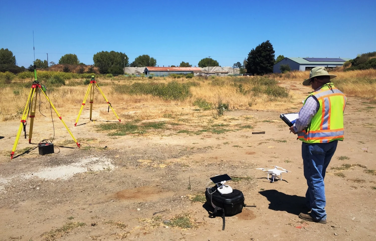
All projects will still require some ground work -- a drone is best thought of as one tool in a hybrid workflow. However, that fieldwork is reduced to setting ground control and collecting any shots that need to be tighter than 0.1’ accuracy or are not visible from the air -- work that can be completed by a solitary surveyor rather than a multi-person crew. The drone can be relied on for the appropriate portions of a job, then merged with data collected from field tools in post-processing, thereby still offering huge time savings.
Saving time is nice, but what actually matters is the larger implication for the business. If a project that would normally take a week can now be completed in less than a day, that means the field team can now complete as many as five projects in the time it would have taken to complete one. What’s more, this tool does not require hiring for a new role. Though operating a drone involves a new skill-set, it does not require hiring a specialized operator. Comparable to becoming a car driver, with moderate professional training, we make a safe, reliable drone pilot of even the most technically unsavvy field surveyor.
“On topo projects is where it really shines: in easy terrain a field surveyor could walk a 50’ grid on 40 acres in 8 hours. With the drone we are on-site for fewer than 2. And we aren’t spending any more office time than we would have before.”
Post-process with existing office resources
Surveying by drone involves rebalancing the proportions of project time from the field to the office. However, with the right workflow and using the right resources, the office time for getting to final line-work from drone data should take no more time than it would have if the job was completed with conventional equipment.
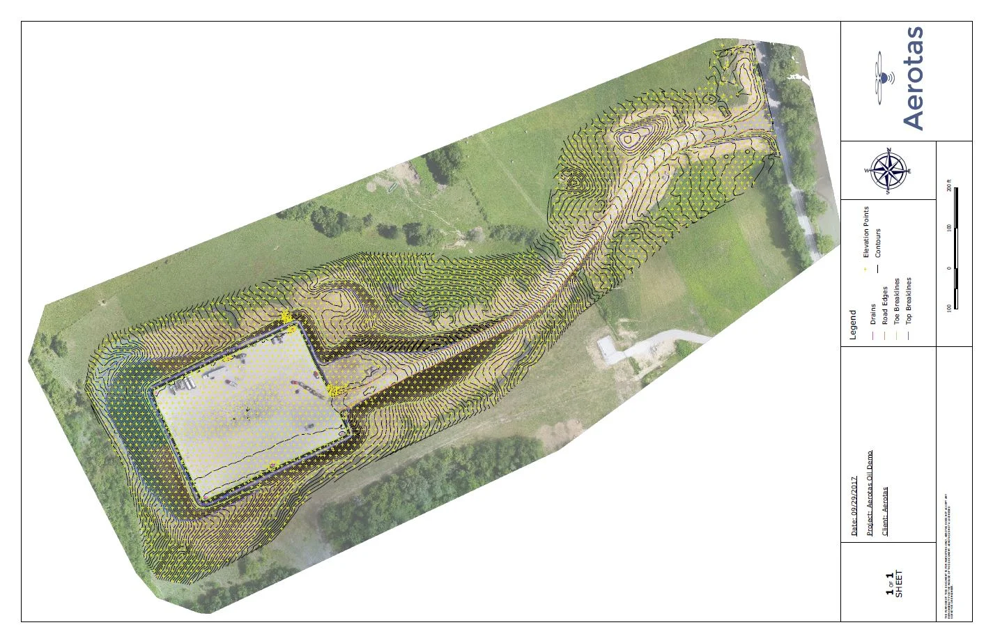
Many surveyors initially compare drone data to horror stories about laser scanner data requiring two hours of data processing for every one hour of field data collection. With the right software workflow, drone data can be processed to final line-work in no more time than when using conventional survey tools. One key tip: use post-processing tools that do not require working with a point cloud to extract line work.
An additional key resource to leverage is outsourcing. The most efficient survey companies we work with will strategically outsource data processing on a project-by-project basis. If a project or client is highly sensitive, they will complete it in-house. If office staff are fully booked, they will outsource. They use their highly-trained and expensive in-house resources where they are going to provide the most benefit, and use inexpensive and fast outsourced options to save money everywhere else. Again, this means that an effective drone program can enable the office team to complete more projects, more flexibly, without additional hiring.
Reduce trips to the field
One of the most valuable but under-considered benefits of the right drone program is that it makes it effortless to always collect more data. This translates to a reduction in field errors, and easy pre-collection of data for future projects.
When the drone data from a project site is processed, it functions as a complete record of the project site. The right software workflow then allows for marking specific elevations or features from this digital record, in the office. This means that if a point is missed, miss-collected, or mislabeled, correcting the error is a matter of a few mouse-clicks, not a several-hour return-trip to the field.
The ease of drone data-collection also means that the firm can easily collect more data than is needed for any specific project. One of our customers tells the story of a client who contracted them for a topo of the front half of his property. On a hunch, and with the addition of less than an hour in the field, the surveyor flew the drone over the entire property -- front and back. Sure enough, the client wound up asking for a topo of the back half of the property as well. The survey team was able to deliver this second project without another field visit, meaning their total time for completing this second project was measured in hours, not days.
Having an automatic complete record finally reduces that most costly and time-sucking issue of all: client disputes. Having a clear, high-resolution, visual record of the project site exactly as it existed on a specific day can prove an invaluable resource in efficiently resolving otherwise intractable disagreements.
By reducing errors, re-visits, and disputes, an effective drone program enables field crews and senior staff to stay focused on the most valuable work: winning and executing on new projects.
Grow without hiring, and excite the next generation
The land surveying industry is in a critical moment. A booming construction economy portends huge growth for the industry, but a shortage of hireable surveyors threatens that growth. It is time for surveyors around the country to make an important shift in how they think about their businesses: it is time to focus on efficiency. The Aerotas Mapping System provide a unique opportunity for making this shift to efficiency.
But drone technology also offer another, more existential benefit to the industry: attracting new talent. The land survey industry gets an undue reputation for being technological laggards. In fact, the industry has leveraged a steady march of ground-breaking new technologies: metric cameras, computer-aided drafting, GPS, laser scanners, robotic total stations, and now drones. But drones are different from these other technologies in one critical way: they have captured the public imagination.
For an industry with an average age in the late 50’s, drones have the potential to solve a critical challenge: they can attract an entire new generation to land surveying. Few industries stand to benefit on a day-to-day basis from a technology that overlaps so closely with the newest hobby of so many young people. Not only is drone technology enabling surveyors to grow their businesses without hiring today, it is spurring the future growth of the industry as a whole.


